Areas of Expertise
Burnside services provided for this project include:
Browse all our services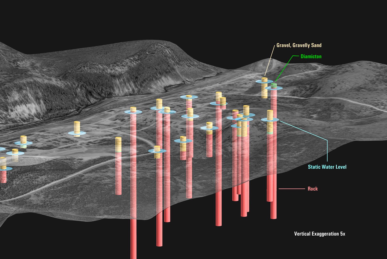
GIS-based Groundwater Analysis
Helping understand the quality and quantity of Ontario's groundwater resources.
Sector:Agencies
Ministry of the Environment, Conservation, and Parks
Multiple Ontario Municipalities
Matthew Dickie
The Ministry of the Environment, Conservation, and Parks (MECP) retained Burnside to complete a series of studies with the purpose of measuring the quantity, quality, and location of water in underground aquifers. These studies helped to improve the understanding of how much groundwater exists and how long it takes to be replenished after water is removed through human activity. The studies also helped to evaluate the potential of groundwater contamination and the migration of contaminates through the groundwater system. GIS was a primary tool employed to achieve this understanding.
Burnside, in association with its partners, conducted 16 groundwater studies between 2000 and 2005 involving GIS. These studies included the Municipalities of Mulmur, Mono, Amaranth, East-Garafraxa, East Luther | Grand Valley, Shelburne, Minto, Orangeville, North Wellington, Sault Ste. Marie, Grey & Bruce Counties, Timmins, Markstay-Warren, Armstrong, and the Lakehead Conservation Region that includes Thunder Bay and the surrounding townships.
GIS served as the primary means to integrate data provided by various ministries of the Ontario Government, data collected in the field, and data provided by the clients. Via GIS, this data was analyzed through geostatistical methodologies, multi-criteria evaluation, and by professional geoscientists. The results were added to spatial databases and rendered
as digital and hardcopy cartographic deliverables.
Effective policies and management practices can only be developed and implemented with a clear understanding of the environmental systems involved. When these natural resources are not readily visible by virtue of being underground, this presents challenges to scientists and policy makers alike. These groundwater protection studies, through their
employment of GIS and related data and technology, have allowed what was an invisible environmental system to become visible on a province-wide basis.
As stated by the MECP, “Depending on the needs and | or concerns of the communities, study results may be used to develop an overall strategy for groundwater protection that can guide the implementation of specific protection measures that are likely to be most effective in the context of particular study areas. For example, study results may be used in the drafting of municipal official plans and zoning by-laws that may restrict land uses in certain areas in a community.”

We encourage you to contact us if you have any questions or require assistance.