Areas of Expertise
Burnside services provided for this project include:
Browse all our services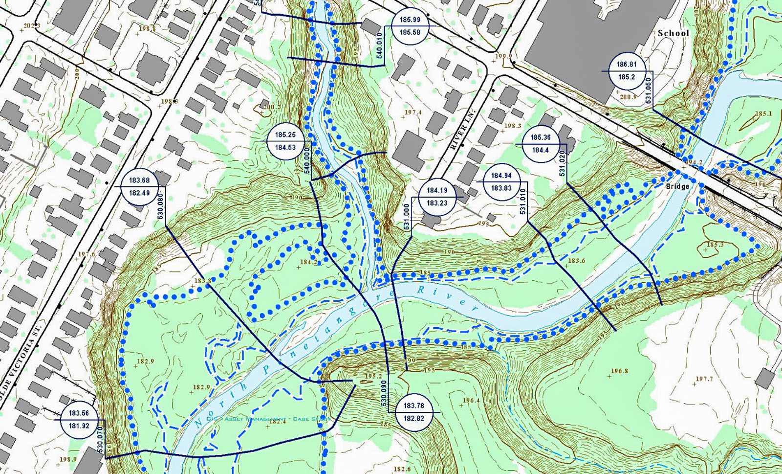
Hydraulic Analysis and Modeling
Producing detailed floodplain maps to protect residents from catastrophic events.
Sector:Municipalities
Municipality of Kincardine
Kincardine, Ontario
Matthew Dickie
The Municipality of Kincardine retained Burnside to produce new floodplain mapping to replace the previous mapping from the 1970s, in order to properly manage and regulate new growth in the Municipality that reflects changes and development over the past several decades. The purpose will be to determine the extent of flooding that can take place from a variety of storm event levels.
The GIS component of this project used the most current GIS based applications available for hydrology and hydraulic analysis, utilizing mapping and terrain data derived through
proven photogrametric techniques. We partnered with Northway Photomap Inc. for the creation of the geo-spatial data required for the project. This data, capable of rendering
mapping to a scale of 1:2,000, provided enough terrain detail for the automated generation of cross-sections required for the HEC-RAS hydraulic analysis modeling.
We employed HEC-GeoRAS for the modeling effort, which allowed for the extraction of high-quality data from the GIS directly into the HEC-RAS model, which was then re-imported into ArcGIS for post processing and mapping. Taking advantage of this GIS interface allowed us to include a higher volume and detail in the overall analysis. Arc Hydro was also employed on this project for the hydrographic investigation required for the Pentatangore River Basin.
The use of GIS on this project represented a more flexible approach to traditional mapping. By treating the “mapping” requirement as the graphical representation of data, flexibility for further updates and expansion of the dataset to include new areas now exists. This approach will mean that the model and mapping can stay relevant to the reality of a growing municipality.
The resulting mapping and dataset will assist the municipality in many of its planning functions ranging from land development, infrastructure upgrading and expansion, and emergency management and response.

We encourage you to contact us if you have any questions or require assistance.